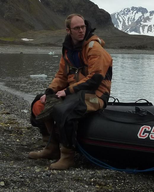
Matt Rowberry has been a research scientist in the Department of Engineering Geology since 2010. He graduated with first class honours from the University of Liverpool in 2003. His doctoral research at the University of Wales, Aberystwyth, focused on reconstructing the tectonic and geomorphological evolution of Wales since the early Cenozoic opening of the North Atlantic while his postdoctoral research at the University of the Witwatersrand, Johannesburg, developed this theme by focusing on reconstructing the tectonic and geomorphological evolution of southern Africa since the Mesozoic breakup of Gondwana. Since joining the Department of Engineering Geology much of his research has centred on studying the process of limestone dissolution in order to better understand its role in the formation of cave systems. At present his research focuses on, first, radon concentration monitoring on active volcanic islands and the application of time series models - particularly from econometrics - to forecast degassing anomalies and, second, developing and fabricating triaxial positioning systems for fracture displacement monitoring that use machine learning algorithms to forecast undesirable events including anthropogenic and natural disasters. Matt is an active member of the British Cave Research Association and a Fellow of the Geological Society of London. He has also submitted peer review assignments for a number of prestigious international journals including Applied Radiation & Isotopes, Earth Science Reviews, Environmental Science & Pollution Research, Geological Magazine, Global & Planetary Change, Geomorphology, Journal of Cave & Karst Studies, and Tectonophysics.
Rowberry, M., Frontera, C., Baroň, I., Kučera, J., Křivánek, L., Martí, X., 2020. A novel positioning system for three dimensional fracture displacement monitoring in the British Cave Science Centre, Poole's Cavern, Buxton, Derbyshire. Cave & Karst Science, v. 47, p. 146-152.
Blahůt, J., Mitrovic-Woodell, I., Baroň, I., René, M., Rowberry, M., Blard, P., Hartvich, F., Meletlidis, S., 2019. Volcanic edifice slip events recorded on the fault plane of the San Andrés Landslide, El Hierro, Canary Islands. Tectonophysics, v. 776, art. no. 228317. https://doi.org/10.1016/j.tecto.2019.228317
Blahůt, J., Balek, J., Klimeš, J., Rowberry, M., Kusák, M., Kalina, J., 2019. A comprehensive global database of giant landslides on volcanic islands. Landslides, v. 16, p. 2045-2052. https://doi.org/10.1007/s10346-019-01275-8
Rowberry, M., Dubois, C., Kaufmann, O., Baele, J., Blahůt, J., 2018. Weathering by dolomite dissolution responsible for the formation of an important palaeontological locality in the Prague Synform. Acta Geodynamica et Geomaterialia, v. 15, p. 297-309. https://doi.org/10.13168/AGG.2018.0022
Blahůt, J., Baroň, I., Sokoľ, L., Meletlidis, S., Klimeš, J., Rowberry, M., Melichar, R., García-Cañada, L., Martí, X., 2018. Large landslide stress states calculated following extreme climatic and tectonic events on El Hierro, Canary Islands. Landslides, v. 15, p. 1801-1814. https://doi.org/10.1007/s10346-018-0993-1
Blahůt, J., Klimeš, J., Rowberry, M., Kusák, M., 2018. Database of giant landslides on volcanic islands - first results from the Atlantic Ocean. Landslides, v. 15, p. 823-827. https://doi.org/10.1007/s10346-018-0967-3
Rinaldi-Montes, N., Rowberry, M., Frontera, C., Garcés, J., Baroň, I., Blahůt, J., Pérez-López, R., Pennos, C., Martí, X., 2017. A contactless positioning system for monitoring discontinuities in three dimensions with geological and geotechnical applications. Review of Scientific Instruments, v. 88, art. no. 074501. https://doi.org/10.1063/1.4993925
Blahůt, J., Rowberry, M., Balek, J., Klimeš, J., Baroň, I., Meletlidis, S., Martí, X., 2017. Monitoring giant landslide detachment planes in the era of big data analytics. In: Mikoš, M., Arbanas, Ž., Yin, Y., & Sassa, K. (eds.), Advancing Culture of Living with Landslides. Springer, Cham, 333-340. https://doi.org/10.1007/978-3-319-53487-9_38
Rowberry, M., Kriegner, D., Holý, V., Frontera, C., Llull, M., Olejník, K., Martí, X., 2016. The instrumental resolution of a moiré extensometer in light of its recent automatisation. Measurement, v. 91, p. 258-265. https://doi.org/10.1016/j.measurement.2016.05.048
Rowberry, M., Martí, X., Frontera, C., Van De Wiel, M., Briestenský, M., 2016. Calculating flux to predict future cave radon concentrations. Journal of Environmental Radioactivity, 157, p. 16-26. https://doi.org/10.1016/j.jenvrad.2016.02.023
Dubois, C., Deceuster, J., Kaufmann, O., Rowberry, M., 2015. A new method to quantify carbonate rock weathering. Mathematical Geosciences, v. 47, p. 889-935. https://doi.org/10.1007/s11004-014-9581-7
Briestenský, M., Rowberry, M., Stemberk, J., Stefanov, P., Vozár, J., Šebela, S., Petro, L’., Bella, P., Gaal, L’., Ormukov, C., 2015. Evidence of a plate wide tectonic pressure pulse provided by extensometric monitoring in the Balkan Mountains (Bulgaria). Geologica Carpathica, v. 66, p. 427-438. https://doi.org/10.1515/geoca-2015-0035
Briestenský, M., Thinová, L., Praksová, R., Stemberk, J., Rowberry, M., Knejflová, Z., 2014. Radon, carbon dioxide, and fault displacements in central Europe related to the Tōhoku Earthquake. Radiation Protection Dosimetry, v. 160, p. 78-82. https://doi.org/10.1093/rpd/ncu090
Dubois, C., Quinif, Y., Baele, J., Barriquand, L., Bini, A., Bruxelles, L., Dandurand, G., Havron, C., Kaufmann, O., Lans, B., Maire, R., Martin, J., Rodet, J., Rowberry, M., Tognini, P., Vergari, A., 2014. The process of ghost rock karstification and its role in the formation of caves. Earth-Science Reviews, v. 131, p. 116-148. https://doi.org/10.1016/j.earscirev.2014.01.006
Tooth, S., McCarthy, T., Rodnight, H., Keen-Zebert, A., Rowberry, M., Brandt, D., 2014. Late Holocene development of a major fluvial discontinuity in floodplain wetlands of the Blood River, eastern South Africa. Geomorphology, v. 205, p. 128-141. https://doi.org/10.1016/j.geomorph.2011.12.045
Briestenský, M., Stemberk, J., Rowberry, M., 2014. The use of damaged speleothems and in situ fault displacement monitoring to characterise active tectonic structures: an example from Západní Cave, Czech Republic. Acta Carsologica, v. 43, p. 129-138. https://doi.org/10.3986/ac.v43i1.626
Rowberry, M., Battiau-Queney, Y., Walsh, P., Błażejowski, B., Bout-Roumazeilles, V., Trentesaux, A., Křížová, L., Griffiths, H., 2014. The weathered Carboniferous Limestone at Bullslaughter Bay, South Wales: the first example of ghost-rock recorded in the British Isles. Geologica Belgica, v. 17, p. 33-42.
Marti, X., Rowberry, M., Blahůt, J., 2013. A MATLAB code for counting the moiré interference fringes recorded by the optical mechanical crack gauge TM-71. Computers & Geosciences, v. 52, p. 164-167. https://doi.org/10.1016/j.cageo.2012.09.029
Klimeš, J., Rowberry, M., Blahůt, J., Briestenský, M., Hartvich, F., Košťák, B., Rybář, J., Stemberk, J., Štěpančíková, P., 2012. The monitoring of slow moving landslides and assessment of stabilisation measures using an optical mechanical crack gauge. Landslides, v. 9, p. 407-415. https://doi.org/10.1007/s10346-011-0306-4
Rowberry, M., 2012. A comparison of three terrain parameters that may be used to identify denudation surfaces within a GIS: a case study from Wales, United Kingdom. Computers & Geosciences, v. 43, p. 147-158. https://doi.org/10.1016/j.cageo.2011.09.016
Rowberry, M., McCarthy, T., Thompson, M., Nomnganga, A., Moyo, L., 2011. The spatial and temporal characterisation of flooding within the floodplain wetland of the Nyl River, Limpopo Province, South Africa. Water SA, v. 37, p. 445-452. https://doi.org/10.10520/EJC116815
Briestenský, M., Stemberk, J., Michalík, J., Bella, P., Rowberry, M., 2011. The use of a karstic cave system in a study of active tectonics: fault displacements recorded at Driny Cave, Malé Karpaty Mts (Slovakia). Journal of Cave and Karst Studies, v. 73, p. 114-123. https://doi.org/10.4311/jcks2010es0166
McCarthy, T., Tooth, S., Jacobs, Z., Rowberry, M., Thompson, M., Brandt, D., Hancox, P., Marren, P., Woodborne, S., Ellery, W., 2011. The origin and development of the Nyl River floodplain wetland: trunk-tributary river interactions in a dryland setting. South African Geographical Journal, v. 93, p. 172-190. https://doi.org/10.1080/03736245.2011.619324
Briestenský, M., Thinová, L., Stemberk, J., Rowberry, M., 2011. The use of caves as observatories for recent geodynamic activity and radon gas concentrations in the Western Carpathians and Bohemian Massif. Radiation Protection Dosimetry, v. 145, p. 166-172. https://doi.org/10.1093/rpd/ncr080
Štěpančíková, P., Rowberry, M., 2008. Rock landforms that reflect differential relief development in the northeastern sector of the Rychlebské hory and the adjacent area of Žulovská pahorkatina (SE Sudeten Mts, Czech Republic). Acta Geodynamica et Geomaterialia, v. 5, p. 297-321.
Walsh, P., Battiau-Queney, Y., Howells, S., Ollier, C., Rowberry, M., 2008. The Gash Breccias of the Pembrokeshire Peninsula, SW Wales. Geology Today, v. 24, p. 137-145. https://doi.org/10.1111/j.1365-2451.2008.00676.x
Rowberry, M., 2008. Constraining the altitudinal range of elevated sub-horizontal denudation surfaces in Wales, U.K., using the elevation-relief ratio. Revista Geográfica Acadêmica, v. 2, p. 26-40.
Rowberry, M., Brewer, P., Macklin, M., 2007. The number, form, and origin of sub-horizontal surfaces in north Ceredigion, Wales, United Kingdom. Norwegian Journal of Geology, v. 87, p. 207-222.
• Fellow of the Geological Society of London
• Member of the British Cave Research Association