Gravimetry is the measurement of the gravity field of the Earth. Size (th) gravity field depends on the amount of mass and its distance from the measuring point, in the case of geophysical survey therefore the density of rocks and individual rock blocks away from the measurement point. Gravimetric prospecting has wide application of basic geological mapping through prospecting of mineral deposits to mikrogravimetrické application in search of old mines, cellars, caves and the like.
Gravimetric data is measured using a gravimeter CG-5 SCINTREX company that measures the gravitational acceleration Gravity meters with an accuracy of 5 (0.01 micron / s2). Geodetic surveying of gravity points is performed using a total station Leica TC1010.


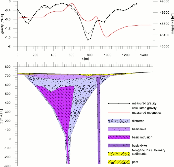
Gravimetric measurement data and their interpretation using mathematical modeling. Tertiary maar at Marienbad.
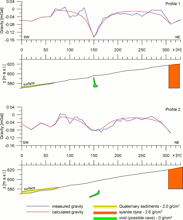
Measured by the gravimetric data and their interpretation using mathematical modeling. Minimum severity of the middle sections is interpreted by the presence of caves in the lenses of marbles. Strašínská quarry near Kašperské Mountains.
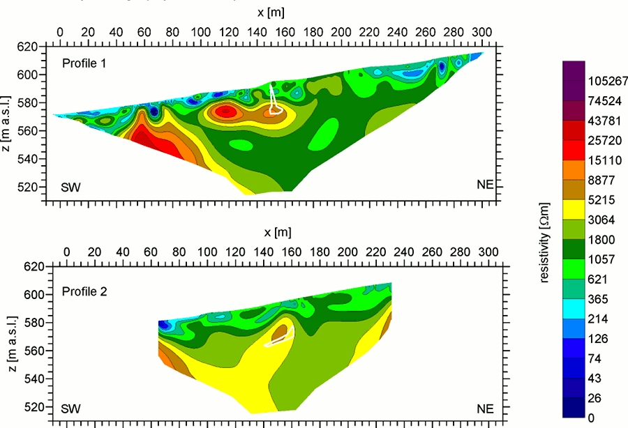
Comparison interpretation of gravimetric data from the previous figure with the results of multi-electrode resistance profiling. Zones of high specific resistances correspond karsted mramorům. White contour shows the contours of the caves resulting from the interpretation of gravimetric data. Strašínská quarry near Kašperské Mountains.
