Geoelectrical systems by GFInstruments, ltd. -- ARES resistivity system (direct current measurememnts, Electrical Resistivity Tomography); CMD Explorer (contactless measurements of resistivity based on electromagnetic induction)
Geoelectrical measurements differentiate subsurface based on the differences in geoelectrical properties. The most common one being the resistivity. Typical applications are mapping of lithological boundaries and fault zone, estimation of sedimentary thickness, archaeological prospection.


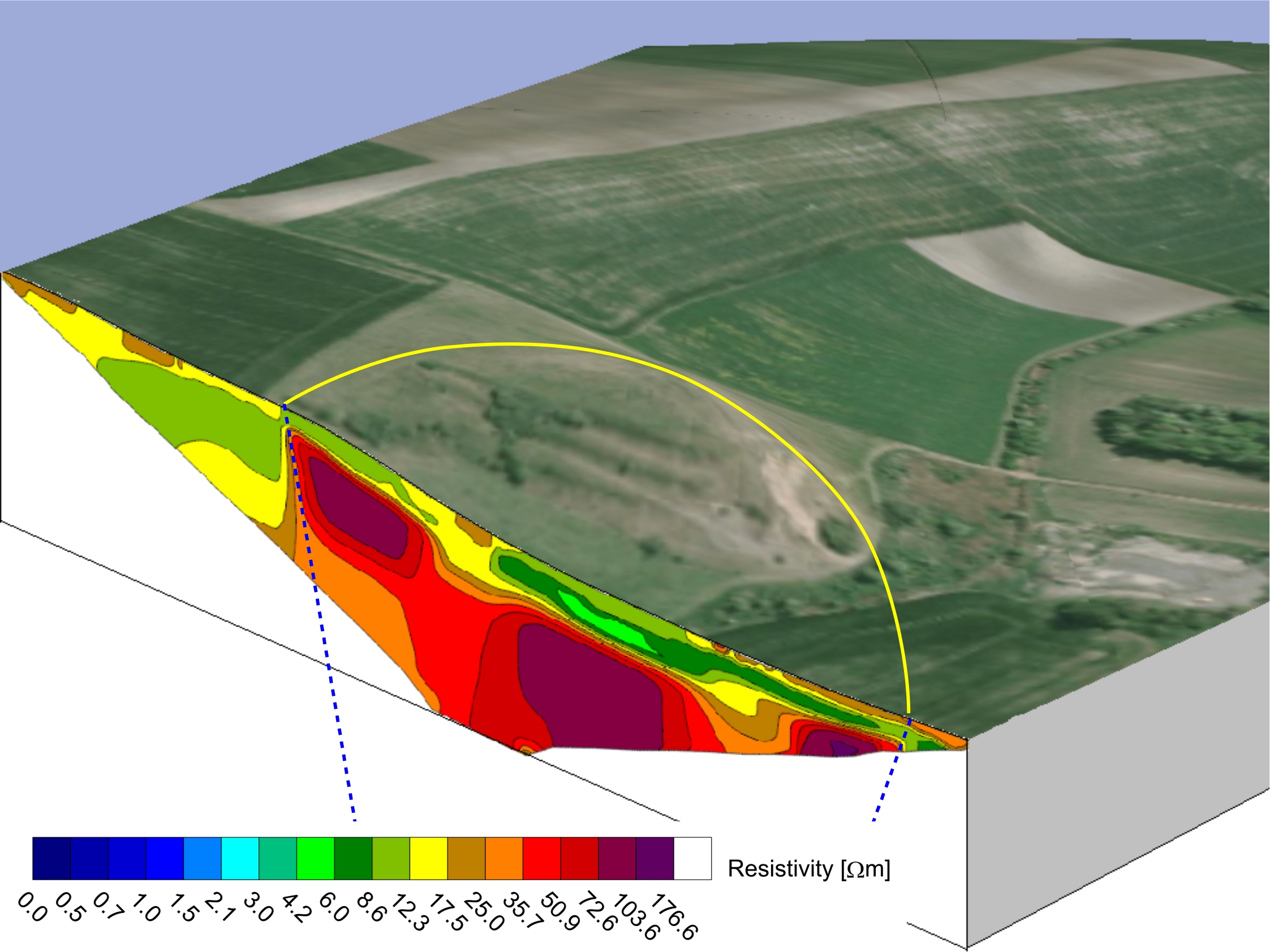
Visualization of a Tertiary maar-diatreme volcano penetrating layers of marlstones in the Czech Cretaceous Basin.
The Hluboká Fault Zone forming the edge of the Budweis Basin. The Proterozoic gneisses (on the right-hand side) are heavily weathered and hence their resistivity is even lower then resistivity of Cretaceous and Tertiary sedimentary infill of the Basin (the left-hand side).
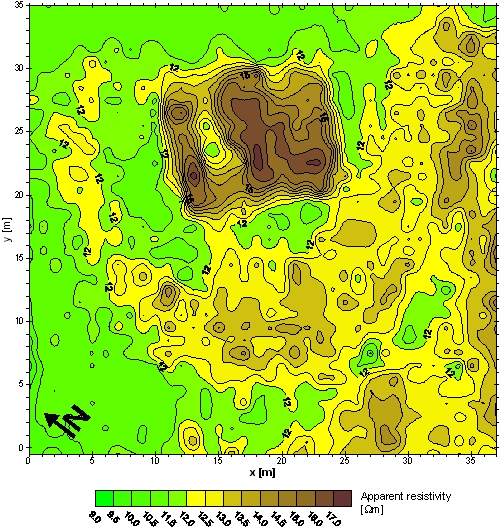
Map of resistivities showing the groundplan of extinct 14th century fortress. No relics are apparent on the surface nowadays, partly due to the intensive ploughing during the last 500 years. Wenner alpha array with 1 meter electrode spacing was used, the measuring grid was 1x1 meter. The relics of walls should appear as areas with increased resistivity (high-resistivity anomaly). The moat might reveal itself either as a low-resistivity or high-resistivity anomaly, depending on its filling.
