Journals / Media
Journals / Media
Média
Dear visitors! Links from this section mostly lead to external websites. Some links, especially for older posts, may therefore no longer exist. In case you come across an incorrect link, we will be happy if you contact the webmaster of the site.
Journal / Book
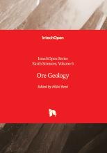
Book Ore Geology, published recently by the British publishing house IntechOpen in London, whose editor is Dr. Miloš René, Ph.D. from the Department of Geochemistry of the IRSM of the CAS, includes five chapters that discuss short characterization of ore geology, mineralogy of selected ore deposits of the tin, tungsten, tantalum, niobium, gold and uranium from Rwanda (Africa), volatile composition of fluid inclusions in gold-bearing quartz deposits from Canada, Burkina Faso, Sudan and New Zealand, solid solution thermochemistry of polymetallic hydrothermal ores and geochemistry and mineralogy of small uranium deposit from the Central European Variscides. Chapters present, in great detail, different mineralogical and geochemical methods used in ore geology.
Doi: 10.5772/intechopen.1005551

Autor: RNDr. Miloš René, CSc.
Video
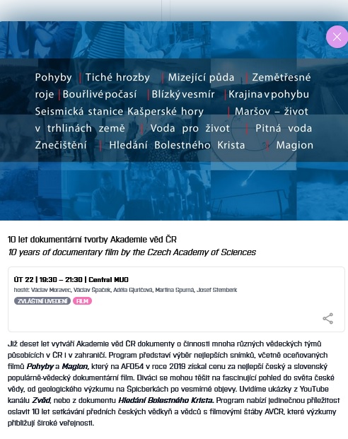
For ten years, the Czech Academy of Sciences has been creating documentaries about the activities of many different scientific teams operating in the Czech Republic and abroad. The program will present a selection of the best films, including the award-winning Pohyby (Movements) and Magion, which won the prize for the best Czech and Slovak popular science documentary film at AFO54 in 2019.
Viewers can look forward to fascinating insight into the world of Czech science, from geological research in Svalbard to space discoveries. The program offers a unique opportunity to celebrate 10 years of encounters between leading Czech scientists and film crews who bring research closer to the general public.
Guest: Josef Stemberk, IRSM of the CAS
22.4.2025, 19:30 - 21:30h
Autor: RNDr. Josef Stemberk, CSc.
Lecture, Seminar / Workshop
10th World Congress on Civil, Sctructural and Environmental Engineering, April 10-12, 2025 Barcelona, Spain.
Conference paper: Towards A Greener Future: Geopolymers in Sustainable Construction and Building Climate Management

Autor: Ing. Ivana Perná, Ph.D.
Press Release
A team of international researchers has achieved a breakthrough in earthquake monitoring in Ethiopia's Southern Main Ethiopian Rift (SMER) by establishing a cutting-edge seismic network near the town of Arba Minch. The initiative addresses long-standing gaps in seismic data coverage, significantly improving earthquake detection and localization accuracy in this tectonically active region.
Led by scientists from the Czech Academy of Sciences, Charles University, and Arba Minch University, the project deployed three new seismic stations in Arba Minch, Dorze, and NechSar National Park. The network has already proven its effectiveness by refining the epicentre location of a May 2024 MW 4.9 earthquake, which was initially placed inaccurately by global monitoring systems.
“This project is a game-changer for understanding seismicity in Ethiopia's Southern Rift,” said Dr. Jan Valenta, lead researcher. “With improved data, we can better assess seismic hazards and support crisis management in rapidly growing urban areas like Arba Minch.”
Integrating Advanced Techniques to Refine Earthquake Data
The new network not only enhances real-time earthquake monitoring but also integrates innovative gravity-based Linsser indications. These analyses identify subsurface fault zones, offering insights into the region's deep-seated tectonic structures. The results have already highlighted previously overlooked fault systems as potential seismic hazard sources.
“The alignment of seismic activity with fault zones mapped through Linsser indications underscores the importance of integrating seismic and gravity data,” added co-author Dr. Lucia Fojtíková. “This will lead to more accurate hazard models for the region.”
Addressing Urban and Regional Risks
The Southern Main Ethiopian Rift, a segment of the East African Rift System, poses significant seismic risks to local communities. While Ethiopia experiences relatively low-magnitude earthquakes, even moderate events can disrupt daily life and instill fear, as seen during the May 2024 quake near Arba Minch.
By providing reliable local data, the network enables researchers to reassess seismic hazard models, particularly in areas where existing maps underestimate potential risks. The findings will inform urban planning and disaster preparedness in one of Ethiopia's fastest-growing regions.
Funding and International Collaboration
This work was made possible through the support of the Czech-UNDP Challenge Fund, a partnership between the United Nations Development Programme (UNDP) and the Czech Republic. The project was financed under the 2023 UNDP-IRH-00048 Czech Challenge Fund, promoting sustainable development through scientific collaboration.
MSc. Tariku Degife from Arba Minch University emphasized the project's local impact: “Strengthening Ethiopia’s seismic monitoring capacity is vital for safeguarding communities. This collaboration is a crucial step toward building resilience.”
Future Outlook
The researchers plan to expand the network and integrate it with regional and global seismic data centers. In addition, the high-quality seismic and gravity data will serve as a foundation for ongoing studies into the tectonic evolution of the East African Rift. The seismic data recorded by the newly installed stations (ARBM, DORZ, and NECH) is freely available upon request from the research team.
For more information, contact:
Dr. Jan Valenta
Institute of Rock Structure and Mechanics, Czech Academy of Sciences
Email: valenta@irsm.cas.cz
MSc. Tariku Degife
Geology Department, Arba Minch University
Email: tarikudegife2015@gmail.com
This project demonstrates the transformative power of scientific collaboration and innovation in addressing pressing geological and societal challenges in the Global South.

Lecture
Faculty of Mathematics and Physics - Charles University, Department of Geophysics
Seminar on current problems in the field of seismic research of the Earth.
M. Wcisło (IRSM CAS) and I. Pšenčík (IG CAS): Ray-theory computations based on weak attenuation concept
Autor: Mgr. Milosz Wcislo
Lecture, Seminar / Workshop
On October 31, 2024, an informal research seminar, devoted to current geoscience research in the Eger Rift and surroundings, will take place in our institute. The seminar is open to interested audience of geoscience students and professionals from academia, industry, and public institutions.
SECTION 4: WESTERN EGER RIFT
P. Hrubcová, T. Fischer, T. Dahm, V. Rapprich, J. Valenta, J. Mrlina, R. Beránek, P. Tábořík, T. Vylita
Drilling in western Eger Rift and surveying of Bažina Maar
P. Štěpančíková, J. Flašar, T. Rockwell, Jakub Stemberk, P. Tábořík, Ch. Goswami, F. Hartvich, H. Sana, N. Brown
Variability of neotectonic activity along the Mariánské Lázně fault
P. Tábořík, P. Štěpančíková, Jakub Stemberk, L. Findžová, T. Fischer, J. Valenta
Discovering the Čirá-Kopanina Fault: Bridging the Gap Between Surface Evidence and Seismic Activity?
J. Flašar, P. Štěpančíková
Geomorphological evidence of tectonic activity of the Mariánské Lázně Fault (Czech Republic) and its influence to stream network evolution
M. Coubal, M. Šťastný, P. Štěpančíková, Jakub Stemberk, J. Schweigstillová, F. Veselovský, D. Kořínková
Study of faulted volcanic bodies – a specific way to reconstruct the paleostress
events during the Plio-Pleistocene. A case study from the Komorní Hůrka Volcano, Bohemian Massif
Journal / Book
Carinthia is also a geological view of the border area. From Lesachtal in the west to the Jauntal in the east, the periadriatic seam stretches. A fault line in the rock that was formed in the course of Earth's history. Since 2014, research has been conducted in the obiro caves. The goal is the earthquake prediction.
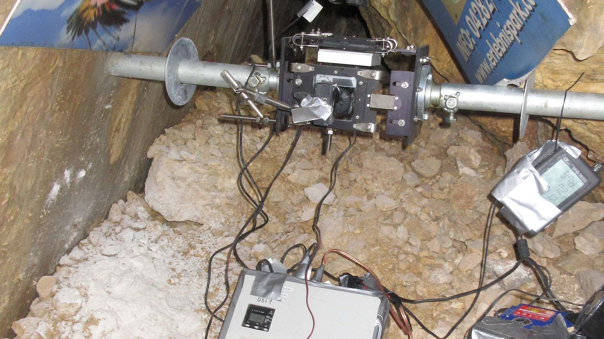
The pal.Idriatic seam stretches from west to east throughout the Alps, from Piedmont in Italy to the north-east of Croatia. In some cases, it is only recognizable by geologists, but in some areas it is also visible, for example in the obircad caves near Bad Eisenkappel. Ivo Baron is a geologist at the Czech Academy of Sciences and, with his research team in the rock fracture line, installed measuring instruments in the obircave to record these movements in the rock. It is a globally unique research project: “Our group is the only one in the world that can make three-dimensional measurements in the microometric field of disturbances.”
Autor: Mgr. Ivo Baroň, PhD.
Audio
Carinthia is a border region from a geological point of view. The Periadriatic Seam stretches from the Lesach Valley in the west to the Jaun Valley in the east. A fault line in the rock that was formed in the course of the Earth's history. Research has been carried out in the Obir Caves since 2014. The aim is to predict earthquakes.
Radio Carinthia afternoon broadcast, programme "Experience nature" (Interview with Ivo Baron from the Department of Engineering Geology about research in the Alps, 3:16minut)
Autor: Mgr. Ivo Baroň, PhD.
Seminar / Workshop
Taiwan-Czech Republic Workshop on Slope and Active Tectonics jointly organized by the ARDWC and National Cheng Kung University, successfully concluded. This workshop brought together geological experts from the Institute of Rock Structure and Mechanics (USMH), Masaryk University and National Cheng Kung University. Professors and students from various Taiwanese universities were also invited to participate, engaging in in-depth discussions on topics related to deep-seated landslides and active tectonics.
During the workshop, experts shared their research findings and experiences, covering fascinating topics such as oblique thrust to strike-slip, application of magnetic susceptibility anisotropy to active faults and landslide masses, and other topics. Participants attentively listened, fostering rich intellectual exchanges that propelled advancements in the geological field.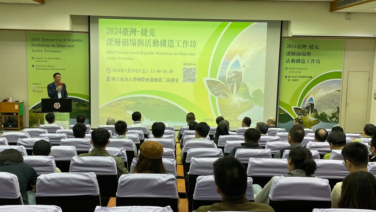
Lecture
Czech Romanian seismology workshop: ADRIA ARRAY LOCAL EXPERIMENT IN VRANCEA (ROMANIA), December 5th-6 th 2023, Conference hall of IRSM CAS
Autor: Mgr. Lucia Fojtíková, Ph.D.
Lecture
Czech Romanian seismology workshop: ADRIA ARRAY LOCAL EXPERIMENT IN VRANCEA (ROMANIA), December 5th-6 th 2023, Conference hall of IRSM CAS
Lecture
The Faculty of Mathematics and Physics, Department of Geophysics, Charles University Prague, holds a seminar on current problems in the field of seismic research every Friday at 2:00 p.m.
J. Málek (IRSM CAS), J. Brokešová (FMP CUNI): Rotragraph − a new instrument for simultaneous measurements of seismic translations and rotations
Autor: RNDr. Jiří Málek, Ph.D.
Lecture
The Faculty of Mathematics and Physics, Department of Geophysics, Charles University Prague, holds a seminar on current problems in the field of seismic research every Friday at 2:00 p.m.
J. Brokešová, O. Novotný (FMP CUNI), J. Málek (IRSM CAS): New velocity structure of the Nový Kostel earthquake-swarm region

Autor: RNDr. Jiří Málek, Ph.D.
Video
TV Report on the measurement of fault activity using the TM71 extensometer in the Vienna Basin, Austria.
ORF TV, program Mayrs Magazin - Wissen fuer alle
Autor: Mgr. Ivo Baroň, PhD.
Lecture
Seminar on current problems in the field of seismic research of the Earth, Department of Geophysics, Faculty of Mathematics and Physics of the Charles University. Lecture by Petra Štěpančíková from IRSM of the CAS.
Lecture
Seminar on current problems in the field of seismic research of the Earth, Department of Geophysics Faculty of Mathematics and Physics of the Charles University. Lecture by Jiří Vackář from IRSM of the CAS.
Journal / Book
Mineralogy book published recently by the British publishing house IntechOpen in London, whose editor is Dr. Miloš René from the Department of Geochemistry of the IRSM of the CAS, includes thirteen chapters that discuss the methodology of specific mineralogical methods, the composition of minerals from different igneous rocks, and the composition of minerals from different sedimentary rocks.It contains detailed mineralogical studies from Africa, Asia, and Europe. Chapters present different scientific mineralogical methods and detailed descriptions of miner.
Autor: RNDr. Miloš René, CSc.
Lecture
Seminar on current problems in the field of seismic research of the Earth, Department of Geophysics, Faculty of Mathematics and Physics of the Charles University. Lecture by Jiří Málek from IRSM of the CAS.
Autor: RNDr. Jiří Málek, Ph.D.
Lecture
Seminar on current problems in the field of seismic research of the Earth, Department of Geophysics, Faculty of Mathematics and Physics (MFF), Charles University Prague, lectured by Jiří Málek and Renata Lukešová from IRSM of the CAS.
Journal / Book
Book Geochemistry, published recently by the British publishing house IntechOpen in London, whose main editor is Dr. Miloš René from the Department of Geochemistry of the IRSM of the CAS, includes fourteen chapters that discuss the chemical composition of various rock complexes, their structural evolution, methodology of specific geochemical methods (isotopic geology), using of geochemical methods for exploration of mineral deposits, structural geology, stratigraphy and lithology.
Autor: RNDr. Miloš René, CSc.
